On my regular Lost blog Wayne and I were talking tunnels, and it inspired me to finally do some research on my lava tube theory for the island. It's not a complicated or important theory, just one built on the thought that since there is a network of tunnels, how did these tunnels get dug out? Not only do the Others/Hostiles always pop up everywhere on the island, as well as Ethan and Goodwin getting to the crash sites fast enough from Otherton to be considered survivors, but Richard sashayed into DI-ville without any determent from the sonic fence at all. And indeed, many of the maps and diagrams that we've been shown have indicators of tunnels. Our previous guesses that vast access tunnels must exist were confirmed in Season 5 and we got to see some of them. So given that it might be near to impossible to create a network of tunnels through a volcanic rock island, I thought that maybe lava tubes might be a natural geographic feature that would aid the indigenous islanders in creating their subterranean network. Wiki of course offered up some nice examples of lava tubes and caves.
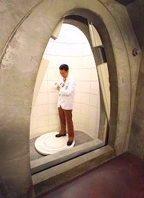
Looking down the axis of a classic lava tube passage, Lava Beds National Monument, California.


http://en.wikipedia.org/wiki/Lava_tube